places in Mgarr
Coronavirus disease (COVID-19) Situation
confirmed cases
121420
deaths
885
Malta
Mgarr
Mgarr
Administrative Region:
Mġarr
population:
3 629
calling code:
+356-2152 xxxx
+356-2752 xxxx
postcode:
MGR ####
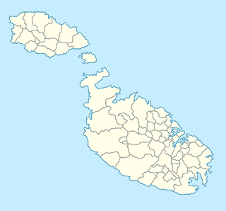
Location on the map of Malta
Mgarr
Health
Doctor A. Zammit Clinic
Xaghra Tal-Knisja, L-Imġarr
Doctor
Health
Point of interest
Establishment
read more
Walk This Way Malta
1 Ras IL-Gebel, L-Imġarr
Health
read more
Park
Blata tal-Melħ
Rabat
Park
read more
Ta' Marija Cave
Mgarr
Park
read more
Azure Window Malta
Mgarr
Park
read more
Bus station
Palazz
Malta
Bus station
read more
Ghajn
Malta
Bus station
read more
Mrejnu 2
Malta
Bus station
read more
Piju
Malta
Bus station
read more
Skorba
Malta
Bus station
read more
Mgarr
Malta
Bus station
read more
Mrejnu
Malta
Bus station
read more
Nahal
Malta
Bus station
read more
Luke
Malta
Bus station
read more
Fisher
Malta
Bus station
read more
Bus Stop
Triq L-Imgarr, Mgarr
Bus station
read more
Fuhhar
Malta
Bus station
read more
Bahrija
Malta
Bus station
read more
Bus Stop
Triq Fisher, L-Imġarr
Bus station
read more
Ghermieri
Malta
Bus station
read more
Lellux
Malta
Bus station
read more
Teatrali
Malta
Bus station
read more
Bajdar
Malta
Bus station
read more
Saqwi
Malta
Bus station
read more
Ghajn Tuffieha Bus Terminus
Mgarr
Bus station
read more
Temi
Malta
Bus station
read more
Florist
Jardinland
Mgarr
Florist
read more
Food
Vella Wholesalers
1, Triq Sir Temi Zammit Zebbiegh Mgarr MGR
Pet store
Grocery or supermarket
Store
Food
Point of interest
Establishment
read more
Maypole Żebbiegħ
Sir Temi Zammit Str, L-Imġarr
Convenience store
Store
Food
Point of interest
Establishment
read more
Agius Agricultural Trading Ltd
Fisher Road, L-Imġarr
Food
read more
Laflafett
Binġemma, L-Imġarr
Food
read more
Mgarr Farmers Coop
Triq Sir Temi Zammit, L-Imġarr
Food
read more
📑
Mgarr all categories
Atm
Bar
Bus station
Cafe
Car repair
Cemetery
Church
Convenience store
Doctor
Electronics store
Establishment
Florist
Food
General contractor
Grocery or supermarket
Gym
Hair care
Hardware store
Health
Home goods store
Local government office
Locality
Lodging
Museum
Natural feature
Neighborhood
Night club
Park
Parking
Pet store
Pharmacy
Point of interest
Police
Premise
Restaurant
Route
School
Store
Supermarket
sublocality level 1
↑