Store nearby Urban Jungle Jagger
Malta
Store nearby Urban Jungle Jagger
Urban Jungle Jagger
Triq San Gwann, Il-Belt Valletta, MT Malta
contacts phone
:
+356 2123 0663
website:
urbanjunglestore.com.mt
Latitude:
35.897875
, Longitude:
14.511808
larger map & directions
read more
nearest Store
34 m
Gifts Unlimited
Republic Street, Valletta
Store
read more
45 m
Ojo Sunglasses Valletta
Republic Street, Valletta
Store
read more
66 m
Parfois
Republic Street, Valletta
Store
read more
77 m
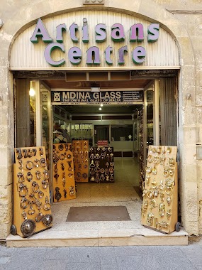
Artisans Centre
Republic Street, Valletta
Store
read more
98 m
Tuaco Opticians
142 Melita Street, Valletta
Store
read more
99 m
Big Market Ltd
51, St. Lucia's Street, Il Belt Valletta
Store
read more
102 m
Go Bananas
247 Republic Street, Valletta
Store
read more
109 m
Bubbles
247 Republic Street, Valletta
Store
read more
127 m
Yves Rocher Valletta
Merchants Street, Valletta
Store
read more
134 m
The Mics
Valletta
Store
read more
143 m
Holland & Barrett Valletta
5B Merchant Street, Il-Belt Valletta
Store
read more
148 m
Expo Subaqua
San Gwann, Il-Belt Valletta
Store
read more
151 m
FURLA SHOP
No 8 Zachery Street Valletta, Valletta
Store
read more
176 m
Malta Vaping
15a st lucia street, Il-Belt Valletta
Store
read more
177 m
Galea's Art Studio
70 South St, Il-Belt Valletta
Store
read more
180 m
L'Erbolario
190, Triq Il-Merkanti, Il-Belt Valletta
Store
read more
185 m
il-Ħanut l-Arka
Koperattiva Kummerċ Ġust, Triq San Pawl, Valletta
Store
read more
186 m
Joseph Calleja
177, St. Lucia street, Valletta
Store
read more
188 m
Chronocash
27 Strait Street, Valletta
Store
read more
227 m
Ink City Tattoo Studio
115 Melita Street, Valletta
Store
read more
243 m
Skill Rock Limited
VINCENTI BUILDINGS, 28/19, (SUITE NO. 1880) STRAIT STREET, Il-Belt Valletta
Store
read more
763 m
Photo & Copy
2/4, Papa Giovanni XXIII Square, Floriana
Store
read more
810 m
Maltco
Triq Is-Suq, Il-Furjana
Store
read more
982 m
Malta Blue Diving @Movida
Tigné Seafront, Tas-Sliema
Store
read more
1.325 km
VEEDOL
Triq Nazzjonali, Il-Furjana
Store
read more
📑
all categories
Accounting
Airport
Amusement park
Aquarium
Art gallery
Atm
Bakery
Bank
Bar
Beauty salon
Bicycle store
Book store
Bowling alley
Bus station
Cafe
Campground
Car dealer
Car rental
Car repair
Car wash
Casino
Cemetery
Church
City hall
Clothing store
Colloquial area
Convenience store
Country
Courthouse
Dentist
Department store
Doctor
Electrician
Electronics store
Embassy
Establishment
Finance
Fire station
Florist
Food
Funeral home
Furniture store
Gas station
General contractor
Grocery or supermarket
Gym
Hair care
Hardware store
Health
Home goods store
Hospital
Insurance agency
Jewelry store
Laundry
Lawyer
Library
Liquor store
Local government office
Locality
Locksmith
Lodging
Meal delivery
Meal takeaway
Mosque
Movie rental
Movie theater
Moving company
Museum
Natural feature
Neighborhood
Night club
Painter
Park
Parking
Pet store
Pharmacy
Physiotherapist
Place of worship
Plumber
Point of interest
Police
Post office
Premise
Real estate agency
Restaurant
Route
Rv park, camping
School
Shoe store
Shopping mall
Spa
Stadium
Storage
Store
Subpremise
Supermarket
Synagogue
Taxi stand
Transit station
Travel agency
University
Veterinary care
Zoo
sublocality level 1
↑