Atm nearby HSBC
Malta
Atm nearby HSBC
HSBC
Gudja, Malta
contacts phone
:
+356
Latitude:
35.8505207
, Longitude:
14.5050165
larger map & directions
read more
nearest Atm
828 m
BOV ATM - MIA - Departures Hall (public area)
MIA Departures Hall,, Ħal Luqa
Atm
read more
965 m
BOV ATM Skyparks
SkyParks Business Center, Luqa
Atm
read more
1.434 km
Bank of Valletta ATM
Dawret It Torri, Santa Luċija
Atm
read more
1.706 km
BOV ATM Luqa
Triq Dun Pawl, Ħal Luqa
Atm
read more
1.814 km
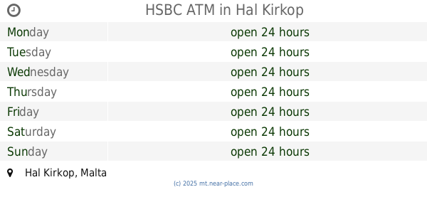
HSBC ATM
Hal Kirkop
Atm
read more
1.94 km
BOV ATM
Żejtun
Atm
read more
2.295 km
Lombard Bank ATM
Centru Civiku Pjazza Antoine de Paule Paola PLA
Atm
Finance
Point of interest
Establishment
read more
2.337 km
BOV ATM
Triq Ġużè Damato, Ħal Tarxien
Atm
read more
2.337 km
BOV advanced deposit ATM
Triq Ġużè Damato, Ħal Tarxien
Atm
read more
2.459 km
BOV ATM
Main Street Shopping Complex, Pjazza Antoine De Paule,, Raħal Ġdid
Atm
read more
2.929 km
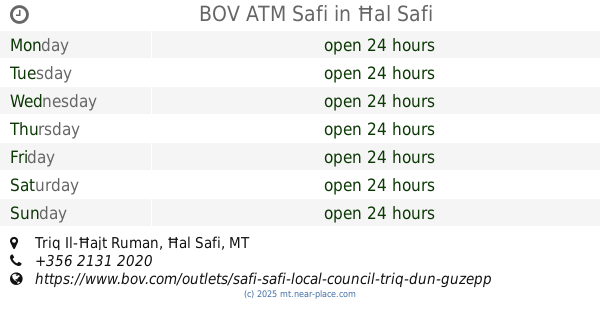
BOV ATM Safi
Triq Il-Ħajt Ruman, Ħal Safi
Atm
read more
3.272 km
APS Bank ATM
Triq Birżebbuġa, Birżebbuġa
Atm
read more
3.462 km
BOV ATM Zurrieq
Sqaq L-Innocenti, Iż-Żurrieq
Atm
read more
3.463 km
HSBC ATM
Birżebbuġa
Atm
read more
3.595 km
BOV ATM Birżebbuġa
Triq il-Bajja s-Sabiħa, Birżebbuġa
Atm
read more
3.64 km
ATM (HSBC)
Triq Il-Kbira, Iż-Żurrieq
Atm
Finance
Point of interest
Establishment
read more
3.64 km
HSBC ATM Zurrieq
Triq Il-Kbira, Iż-Żurrieq
Atm
read more
3.695 km
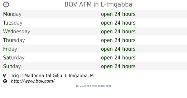
BOV ATM
Triq Il-Madonna Tal-Gilju, L-Imqabba
Atm
read more
3.828 km
HSBC Branch
Ħaż-Żabbar
Atm
read more
3.907 km
BOV
Ħaż-Żabbar
Atm
read more
4.111 km
APS ATM
Ħaż-Żabbar
Atm
read more
4.719 km
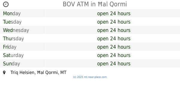
BOV ATM
Triq Helsien, Ħal Qormi
Atm
read more
4.987 km
HSBC ATM
Triq J. Borg, L-Imsida
Atm
read more
5.131 km
HSBC ATM Marsaskala
Marsaskala
Atm
read more
5.331 km
Bank of Valletta ATM
Triq Fleur - De - Lys, Birkirkara
Atm
read more
📑
all categories
Accounting
Airport
Amusement park
Aquarium
Art gallery
Atm
Bakery
Bank
Bar
Beauty salon
Bicycle store
Book store
Bowling alley
Bus station
Cafe
Campground
Car dealer
Car rental
Car repair
Car wash
Casino
Cemetery
Church
City hall
Clothing store
Colloquial area
Convenience store
Country
Courthouse
Dentist
Department store
Doctor
Electrician
Electronics store
Embassy
Establishment
Finance
Fire station
Florist
Food
Funeral home
Furniture store
Gas station
General contractor
Grocery or supermarket
Gym
Hair care
Hardware store
Health
Home goods store
Hospital
Insurance agency
Jewelry store
Laundry
Lawyer
Library
Liquor store
Local government office
Locality
Locksmith
Lodging
Meal delivery
Meal takeaway
Mosque
Movie rental
Movie theater
Moving company
Museum
Natural feature
Neighborhood
Night club
Painter
Park
Parking
Pet store
Pharmacy
Physiotherapist
Place of worship
Plumber
Point of interest
Police
Post office
Premise
Real estate agency
Restaurant
Route
Rv park, camping
School
Shoe store
Shopping mall
Spa
Stadium
Storage
Store
Subpremise
Supermarket
Synagogue
Taxi stand
Transit station
Travel agency
University
Veterinary care
Zoo
sublocality level 1
↑