Bar nearby Matthew's Flat
Malta
Bar nearby Matthew's Flat
Matthew's Flat
Xaghra, Malta
contacts phone
:
+356
Latitude:
36.0501686
, Longitude:
14.2684625
larger map & directions
read more
nearest Bar
268 m
Xaghra Band Club - Soċjeta' Filarmonika Victory A.D. 1898
Soċjeta' Filarmonika Victory A.D. 1898 Triq Marija Bambina, XRA 2111, Għawdex, Xaghra
Bar
read more
289 m
Xaghra United Club House
G Diacono, Ix-Xagħra
Bar
read more
331 m
Stephen's Confectionery and Snack Bar
8th September 2005 Avenue, XRA9021, Gozo, Ix-Xagħra
Bar
read more
368 m
Coronation Bar
Triq II Knisja Xagħra XRA 1347
Bar
read more
380 m
73 In the Square
73 Pjazza Vitorja, Xaghra, Gozo
Bar
read more
381 m
Rubble Bar
Xagħra
Bar
read more
393 m
The Hideaway
32 Triq It-Tmienja u Ghoxrin ta' April 1688, Ix-Xagħra
Bar
read more
1.793 km
Westend Bar Terrace
Triq L-Imġarr, Ix-Xewkija
Bar
read more
1.856 km
Vinyard Restaurant
Triq L-Imġarr, Ir-Rabat Għawdex
Bar
read more
2.238 km
The American Bar
Nadur
Bar
read more
2.432 km
Glassbox Bar
Michelangelo Refalo Square, Marsalforn, Gozo, Iż-Żebbuġ
Bar
read more
2.529 km
Glory Of England Bar
Victoria
Bar
read more
2.531 km
Kyra'sInn
Triq Il-Port, Iż-Żebbuġ
Bar
read more
2.611 km
Gebuba
Triq il Knisja, Nadur
Bar
read more
2.698 km
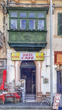
Red Cafe
24, Independence Square VCT 1023, Victoria
Bar
read more
2.703 km
Tepie's Coffee Bar
Triq is-Suq, Ir-Rabat Għawdex
Bar
read more
2.733 km
Coney Island Bar
13 Triq Sir Adrian Dingli, Ir-Rabat Għawdex
Bar
read more
2.832 km
Maħraġ Quak Bar
Il Knisja, In-Nadur
Bar
read more
2.859 km
Każin tal-Banda Filarmonika Nadur
Triq Dicembru Tlettax, Nadur
Bar
read more
3.247 km
Tony's Bar
Pjazza Madonna Ta' Loreto, Għajnsielem
Bar
read more
3.494 km
Sannat Lions Football Club
21, Pjazza Santa Margerita, Sannat
Bar
read more
3.673 km
Ta Rosina
34 saguna street maltz gozo, Ta' Sannat
Bar
read more
3.754 km
Horatio's Upper Deck
Triq Manoel de Vilhena, Mġarr
Bar
read more
3.812 km
Il-Luzzu
Mgarr
Bar
read more
3.814 km
Royal Lady
Triq Martino Garces, Qala
Bar
read more
📑
all categories
Accounting
Airport
Amusement park
Aquarium
Art gallery
Atm
Bakery
Bank
Bar
Beauty salon
Bicycle store
Book store
Bowling alley
Bus station
Cafe
Campground
Car dealer
Car rental
Car repair
Car wash
Casino
Cemetery
Church
City hall
Clothing store
Colloquial area
Convenience store
Country
Courthouse
Dentist
Department store
Doctor
Electrician
Electronics store
Embassy
Establishment
Finance
Fire station
Florist
Food
Funeral home
Furniture store
Gas station
General contractor
Grocery or supermarket
Gym
Hair care
Hardware store
Health
Home goods store
Hospital
Insurance agency
Jewelry store
Laundry
Lawyer
Library
Liquor store
Local government office
Locality
Locksmith
Lodging
Meal delivery
Meal takeaway
Mosque
Movie rental
Movie theater
Moving company
Museum
Natural feature
Neighborhood
Night club
Painter
Park
Parking
Pet store
Pharmacy
Physiotherapist
Place of worship
Plumber
Point of interest
Police
Post office
Premise
Real estate agency
Restaurant
Route
Rv park, camping
School
Shoe store
Shopping mall
Spa
Stadium
Storage
Store
Subpremise
Supermarket
Synagogue
Taxi stand
Transit station
Travel agency
University
Veterinary care
Zoo
sublocality level 1
↑