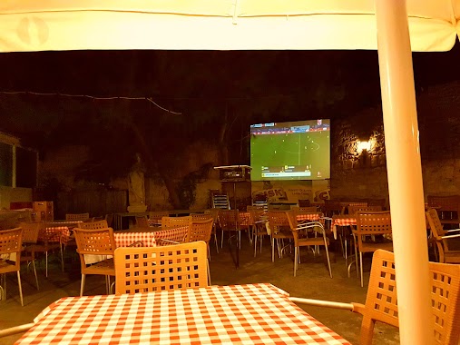
Bar nearby Victoria Band Club
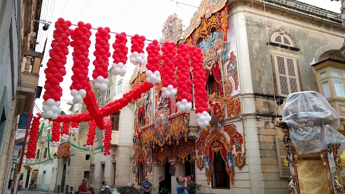
Malta
Bar nearby Victoria Band Club
Victoria Band Club
Naxxar, Malta
contacts phone
:
+356
Latitude:
35.9145709
, Longitude:
14.4428114
larger map & directions
read more
nearest Bar
112 m
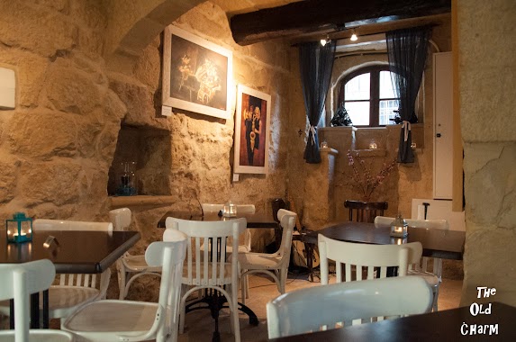
The Old Charm
Triq Santa Luċija, Sqaq Nru 6, In-Naxxar
Bar
read more
113 m
Cafe OK Bar
Naxxar
Bar
read more
147 m
Caesar's House
33 NXR 9021, Triq Tal-Labour, Naxxar
Bar
read more
194 m
Cellini
Parish Street, Naxxar
Bar
read more
322 m
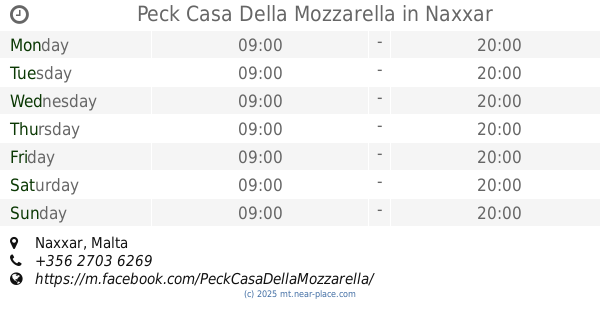
Peck Casa Della Mozzarella
Naxxar
Bar
read more
1.3 km
mystic pub
Triq l-Oratorju, Ħal Għargħur
Bar
read more
1.405 km
Chelsea Supporters Club Malta
Barrieri, Il-Mosta
Bar
read more
1.416 km
Circolo Bar & Kafe
Sqaq Warda, Ħal Għargħur
Bar
read more
1.417 km
Tal-Villagg cafe & wine lounge
77. Triq il-Forn, Ħal Lija
Bar
read more
1.418 km
Grasshopper
Triq Preziosi, Ħal Lija
Bar
read more
1.502 km
Billiards Hall
Triq Il-Kungress Ewkaristiku, Il-Mosta
Bar
read more
1.517 km
Ta Martin
Triq Il-Kungress Ewkaristiku, Il-Mosta
Bar
read more
1.583 km
Il Vecchio Forno
17 Triq Il-Kungress Ewkaristiku, Il-Mosta
Bar
read more
1.69 km
Mellows cafe
Triq Il-Wied, Il-Mosta
Bar
read more
1.718 km
Dimples Pub
Triq Nicolo` Isouard, Mosta, Il-Mosta
Bar
read more
1.734 km
Red Devils Bar
Mosta
Bar
read more
1.739 km
Mosta Bar
Triq Il-Kbira, Il-Mosta
Bar
read more
1.785 km
City Bar
Triq Il-Kbira, Mosta
Bar
read more
1.8 km
Tal-Mekek
Ta' L-Ibraġġ, Ħal Għargħur
Bar
read more
1.88 km
Cosa Nostra
183 Triq Il-Kbira, Mosta
Bar
read more
1.909 km
Fra Giuseppe
Triq Dun Spir Sammut Main Street, Balzan
Bar
read more
2.008 km
Balzan Football Club
Triq It- Tliet Knejjes, Ħal Balzan
Bar
read more
2.183 km
Four Seasons Wine Bar
Triq il-Papa Urbanu VIII, Ħal Balzan
Bar
read more
2.223 km
Old Smuggler's Bar & Restaurant
Balzan
Bar
read more
2.584 km
Hefu Bar
Birkirkara
Bar
read more
📑
all categories
Accounting
Airport
Amusement park
Aquarium
Art gallery
Atm
Bakery
Bank
Bar
Beauty salon
Bicycle store
Book store
Bowling alley
Bus station
Cafe
Campground
Car dealer
Car rental
Car repair
Car wash
Casino
Cemetery
Church
City hall
Clothing store
Colloquial area
Convenience store
Country
Courthouse
Dentist
Department store
Doctor
Electrician
Electronics store
Embassy
Establishment
Finance
Fire station
Florist
Food
Funeral home
Furniture store
Gas station
General contractor
Grocery or supermarket
Gym
Hair care
Hardware store
Health
Home goods store
Hospital
Insurance agency
Jewelry store
Laundry
Lawyer
Library
Liquor store
Local government office
Locality
Locksmith
Lodging
Meal delivery
Meal takeaway
Mosque
Movie rental
Movie theater
Moving company
Museum
Natural feature
Neighborhood
Night club
Painter
Park
Parking
Pet store
Pharmacy
Physiotherapist
Place of worship
Plumber
Point of interest
Police
Post office
Premise
Real estate agency
Restaurant
Route
Rv park, camping
School
Shoe store
Shopping mall
Spa
Stadium
Storage
Store
Subpremise
Supermarket
Synagogue
Taxi stand
Transit station
Travel agency
University
Veterinary care
Zoo
sublocality level 1
↑