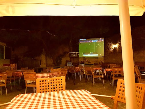
Bar nearby Football Factory
Malta
Bar nearby Football Factory
Football Factory
Triq B. Bontadini, Birkirkara, MT Malta
contacts phone
:
+356
Latitude:
35.8942211
, Longitude:
14.4577721
larger map & directions
read more
nearest Bar
345 m
Rush Hour Snack Bar
Birkirkara
Bar
read more
411 m
Old Smuggler's Bar & Restaurant
Balzan
Bar
read more
466 m
Hefu Bar
Birkirkara
Bar
read more
520 m
Four Seasons Wine Bar
Triq il-Papa Urbanu VIII, Ħal Balzan
Bar
read more
578 m
Gove Bar
Triq Il - Wied, Birkirkara
Bar
read more
627 m
Zmerc Pub
131 Birbal Street, Ħal Balzan
Bar
read more
669 m
Balzan Football Club
Triq It- Tliet Knejjes, Ħal Balzan
Bar
read more
734 m
Mezzanin
Balzan
Bar
read more
769 m
Fra Giuseppe
Triq Dun Spir Sammut Main Street, Balzan
Bar
read more
855 m
Mercury Snack Bar (Mriehel)
Triq L-Imprendituri, Birkirkara
Bar
read more
894 m
L Akwadott Snack Bar
Triq San Gwakkin, Birkirkara
Bar
read more
971 m
St. Anthony Band Club
Triq L-Imsida, Birkirkara
Bar
read more
1.179 km
Lija Bocci Club
Lija
Bar
read more
1.225 km
Malta Labour Party club
Vjal it-Transfigurazzjoni, Ħal Lija
Bar
read more
1.377 km
Tal-Villagg cafe & wine lounge
77. Triq il-Forn, Ħal Lija
Bar
read more
1.382 km
Grasshopper
Triq Preziosi, Ħal Lija
Bar
read more
1.709 km
Ta' Cardona Wine Bar
13,Triq il-Kbira, Qormi
Bar
read more
1.717 km
Charles Bar
Triq Mro. Guiseppe Camilleri, Birkirkara
Bar
read more
1.723 km
Charles Bar
Triq MRO Giuseppe Camilleri, Birkirkara
Bar
Point of interest
Establishment
read more
1.885 km
Għaqda Mużikali San Ġorġ Marti AD.1893
Triq Il-Kbira, Ħal Qormi
Bar
read more
2.128 km
Caccu Social Club
310 Triq Il-Kbira, Ħal Qormi
Bar
read more
2.148 km
Da Roberto Il gusto dell'isola
R.Caruana Dingli, San Ġwann
Bar
read more
2.315 km
Down Town Bar
San Gwann
Bar
read more
2.477 km
Gammika Pub
Triq Spiteri Fremond, Ħal Qormi
Bar
read more
2.721 km
Rubies Bar
Triq San Andrija, San Gwann
Bar
read more
📑
all categories
Accounting
Airport
Amusement park
Aquarium
Art gallery
Atm
Bakery
Bank
Bar
Beauty salon
Bicycle store
Book store
Bowling alley
Bus station
Cafe
Campground
Car dealer
Car rental
Car repair
Car wash
Casino
Cemetery
Church
City hall
Clothing store
Colloquial area
Convenience store
Country
Courthouse
Dentist
Department store
Doctor
Electrician
Electronics store
Embassy
Establishment
Finance
Fire station
Florist
Food
Funeral home
Furniture store
Gas station
General contractor
Grocery or supermarket
Gym
Hair care
Hardware store
Health
Home goods store
Hospital
Insurance agency
Jewelry store
Laundry
Lawyer
Library
Liquor store
Local government office
Locality
Locksmith
Lodging
Meal delivery
Meal takeaway
Mosque
Movie rental
Movie theater
Moving company
Museum
Natural feature
Neighborhood
Night club
Painter
Park
Parking
Pet store
Pharmacy
Physiotherapist
Place of worship
Plumber
Point of interest
Police
Post office
Premise
Real estate agency
Restaurant
Route
Rv park, camping
School
Shoe store
Shopping mall
Spa
Stadium
Storage
Store
Subpremise
Supermarket
Synagogue
Taxi stand
Transit station
Travel agency
University
Veterinary care
Zoo
sublocality level 1
↑